Coastal landforms are the result of continuous interaction between marine processes and terrestrial materials. Among these processes, tides play a fundamental role in shaping the interface between land and sea. Their rhythmic rise and fall, governed by gravitational forces, mobilise and redistribute sediments, thereby influencing the morphology of coastlines over various timescales. Understanding how tides contribute to coastal evolution is essential for coastal management and for interpreting sedimentary records.
This article examines the geomorphic work of daily tides, focusing on the mechanisms by which tidal cycles drive sediment transport and lead to the formation of distinctive features such as tidal flats and salt marshes. It discusses the factors that control tidal range and energy, the pathways of sediment movement, and the characteristic landforms that emerge in different coastal settings. The perspective is process-oriented, emphasising the dynamic and context-dependent nature of tidal influence.
While the focus is on tidal processes, it is important to recognise that coastal landforms are shaped by a combination of forces, including waves, currents, and human activities. Tides interact with these factors in complex ways, and the resulting morphology reflects the balance among them. The information presented here aims to provide a clear overview of tidal geomorphology without implying deterministic outcomes or offering specific management recommendations.
Tidal Cycles and Their Energy
Tides are periodic variations in sea level caused primarily by the gravitational attraction of the Moon and the Sun, combined with the centrifugal effect of Earth’s rotation. The tidal cycle typically consists of two high tides and two low tides each day, although the exact pattern varies with location and astronomical alignments. The vertical difference between high and low tide, known as tidal range, is a key control on the extent of intertidal areas and the energy available for sediment movement.
The energy of tidal currents is proportional to the square of their velocity, which in turn depends on tidal range, basin geometry, and the volume of water exchanged. In confined settings such as estuaries and inlets, tidal currents can reach speeds sufficient to erode and transport coarse sediments, whereas in more open coastal areas, tidal currents are generally weaker and primarily move finer particles. The interaction of tidal currents with the sea bed generates shear stress, which may entrain sediments when a threshold is exceeded.
Tidal asymmetry, the difference between flood and ebb current speeds and durations, further influences net sediment transport. In many estuaries, the flood tide is shorter and stronger than the ebb, leading to a net landward movement of sediment. Conversely, ebb-dominant systems may export sediment seaward. Such asymmetries contribute to the gradual accumulation or erosion of tidal flats and the migration of channels.
Sediment Transport by Tidal Currents
Tidal currents transport sediment in two primary ways: as bedload, where particles roll or saltate along the bed, and as suspended load, where fine particles are carried within the water column. The mode of transport depends on sediment size, current speed, and turbulence. Cohesive sediments such as clay and silt tend to flocculate in saline water, forming larger aggregates that settle more readily. These processes are fundamental to the development of muddy tidal flats and salt marshes.
The net direction of sediment transport is determined by the integration of tidal currents over time, including residual circulation and the influence of waves and river discharge. In estuaries, the estuarine circulation—characterised by seaward flow at the surface and landward flow near the bed—can trap sediments, leading to the formation of turbidity maxima. These zones of high suspended sediment concentration are often sites of rapid deposition.
Seasonal and episodic events, such as storms and river floods, can significantly alter sediment supply and transport pathways. Therefore, the morphological evolution of tidal landforms is not solely a function of daily tides but also reflects the variability of external forcings. The balance between sediment supply and hydrodynamic energy determines whether a tidal flat accretes, remains stable, or erodes.
Formation of Tidal Flats and Salt Marshes
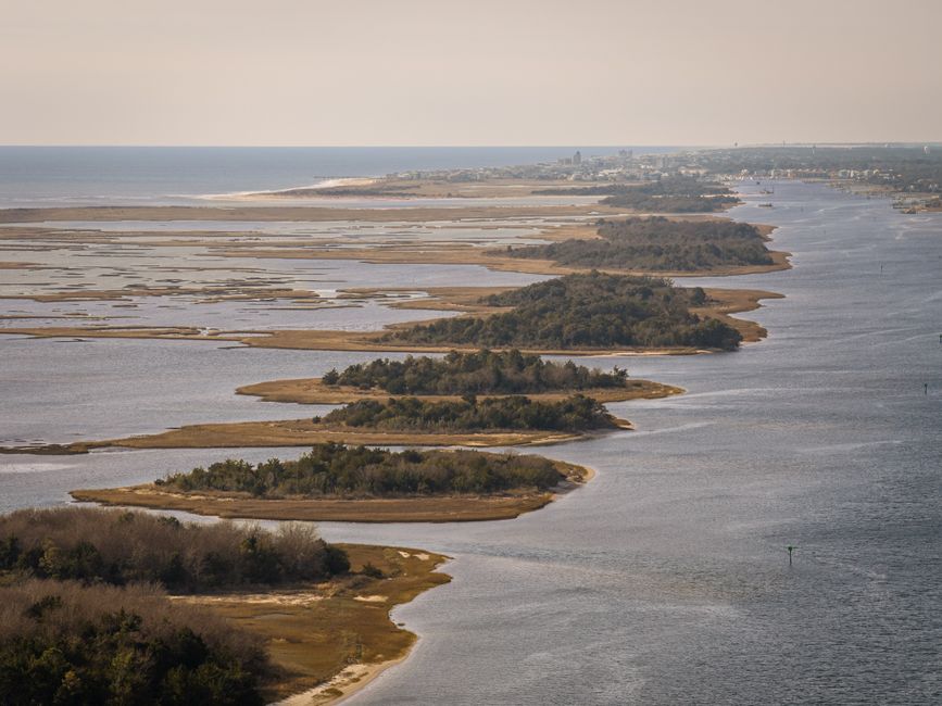
Tidal flats are extensive, gently sloping areas of mud or sand that are exposed at low tide and submerged at high tide. They typically form in sheltered environments where tidal currents are moderate and sediment supply is sufficient. The vertical accretion of tidal flats occurs when sediment deposition exceeds erosion, often facilitated by the baffling effect of vegetation and the binding action of biofilms. As flats accrete, they may eventually reach a level where they are inundated less frequently, allowing salt-tolerant plants to colonise.
Salt marshes develop in the upper intertidal zone, where the frequency and duration of tidal inundation are reduced. The establishment of halophytic vegetation traps fine sediment and organic matter, promoting further accretion and raising the marsh surface. This positive feedback between vegetation growth and sediment deposition is a key mechanism in marsh development. However, marshes are also vulnerable to erosion and submergence, particularly where sediment supply is limited or where sea level rises rapidly.
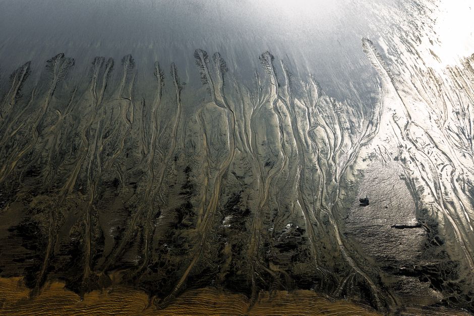
The morphology of tidal flats and salt marshes is characterised by features such as tidal creeks, levees, and salt pans. Tidal creeks serve as conduits for water and sediment, and their networks evolve through erosion and deposition. Levees form along creek banks where sediment is deposited during overbank flooding. Salt pans are bare, depressed areas that may form due to localized erosion or vegetation die-off. These features contribute to the spatial heterogeneity of tidal wetlands.
Influence of Tidal Range and Coastal Setting
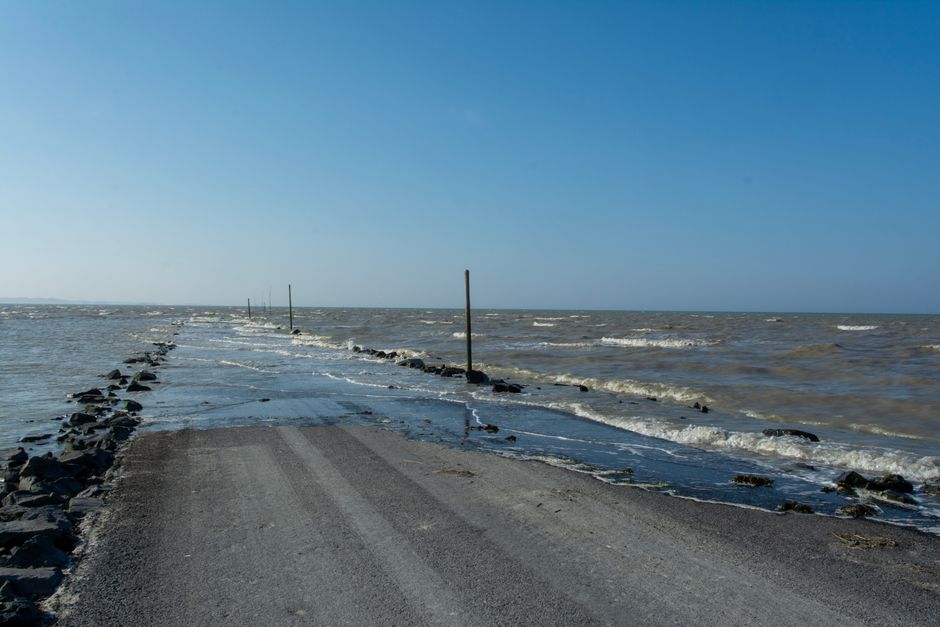
The tidal range exerts a strong control on the type and scale of coastal landforms. In macrotidal environments, where the range exceeds 4 metres, extensive tidal flats and marshes are common, and tidal currents are powerful enough to shape large-scale bedforms such as sand ridges. In microtidal settings, with a range of less than 2 metres, wave action often dominates, and tidal landforms are more restricted in extent. The relative importance of tides versus waves can be assessed using parameters such as the relative tidal range.
Coastal configuration also matters. Estuaries, lagoons, and embayments provide sheltered conditions that favour tidal deposition, while exposed coasts experience greater wave energy that can rework tidal sediments. The interaction between tidal currents and wave-driven processes can lead to complex morphodynamics, including the formation of beach-ridge plains and cheniers. Furthermore, human interventions such as dredging, land reclamation, and coastal defence structures can alter tidal prism and sediment dynamics, with implications for landform evolution.
It is important to note that the geomorphic work of tides operates over a range of timescales, from daily fluctuations to centennial and millennial trends. Short-term observations may not capture the full trajectory of change, and long-term monitoring is often necessary to distinguish natural variability from anthropogenic impacts. Consequently, understanding tidal landform dynamics requires a combination of field studies, remote sensing, and numerical modelling.
Monitoring and Research Approaches
Investigating how tides shape coastal landforms involves a variety of methods. Hydrodynamic measurements, such as current velocity and water level records, provide data on the forces acting on the bed. Sediment sampling and bed-level monitoring reveal patterns of erosion and accretion. Remote sensing techniques, including satellite imagery and LiDAR, enable mapping of intertidal topography and habitat extent over large areas. These approaches are often integrated within a conceptual or numerical framework to interpret morphological change.
For organisations involved in coastal assessment, such as Coastline Surveys, the application of standardised survey protocols and data analysis can support informed decision-making. However, the complexity of tidal systems means that predictions carry inherent uncertainties, and results should be interpreted with caution. The following list summarises key considerations for tidal geomorphic studies:
- Characterise the tidal regime, including range, asymmetry, and residual currents.
- Quantify sediment sources, pathways, and sinks.
- Assess the role of waves, rivers, and human activities.
- Monitor morphological change at appropriate temporal and spatial scales.
- Use multiple lines of evidence to validate interpretations.
By combining these elements, researchers and practitioners can develop a more comprehensive understanding of tidal landform dynamics, which may inform coastal management strategies. Nevertheless, the inherent variability of coastal systems means that any intervention should be adaptive and based on site-specific evidence.
The interplay of tidal processes with other coastal forces creates a dynamic equilibrium that is rarely static, highlighting the need for ongoing observation and flexible approaches.
In conclusion, tides are a pervasive geomorphic agent along coastlines, driving sediment transport and creating distinctive landforms such as tidal flats and salt marshes. Their influence is modulated by tidal range, coastal setting, and external factors, resulting in a diverse array of morphological expressions. Recognising the conditional and context-dependent nature of tidal processes is essential for interpreting coastal evolution and for making informed decisions about coastal environments.